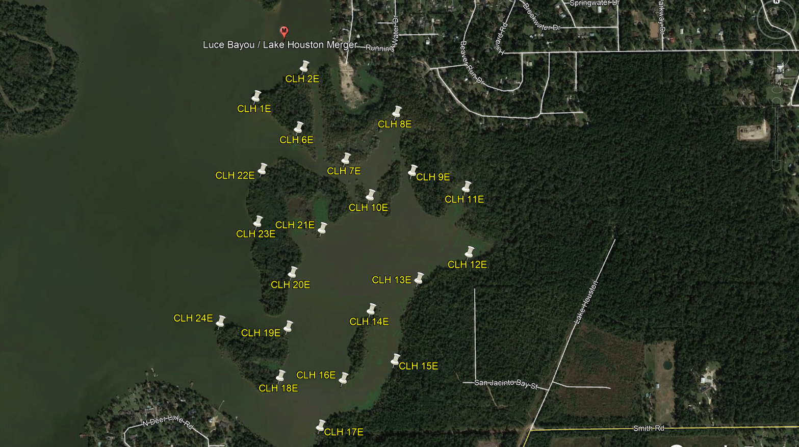
Central Lake Houston East (CLH XE)
The “Central Lake Houston” caches are denoted by cache names CLH XE, CLH XC, CLH XW, & Lake Houston Islands (LHI X) depending on which section of the lake they lie in. The area is bounded to the north and east by the merger of Luce Bayou into Lake Houston, to the south by the FM1960 Bridge, and to the west by the West Lake Houston Bridge. Depending on which group of caches you are after determines the best launch point.
Central Lake Houston East GPS Points
CLH XE caches require the longest paddle and can be reached by launching from BJ’s Marina to the north, Lake Houston Marina to the south, or Ponderosa Marina up Luce Bayou.
- BJ's Marina
- N 30° 3.529'
- W 95° 7.910'
- BJ’s Marina charges a $5 fee for launching.
- A motorized boat, on a trailer, may be launched at BJ’s however due to the low angle of the ramp it is only recommended for use by flat bottom jons and similar type boats. We recommend Ponderosa Marina or Lake Houston Marina for the launching of larger boats.
- Lake Houston Marina
- N 30° 1.120'
- W 95° 7.150'
- Lake Houston Marina charges a $10 fee for launching.
- Ponderosa Marina
- N 30° 3.384'
- W 95° 5.955'
- Ponderosa Marina charges a $7 fee for launching.
Central Lake Houston East

